
More project photos (3)
The problem
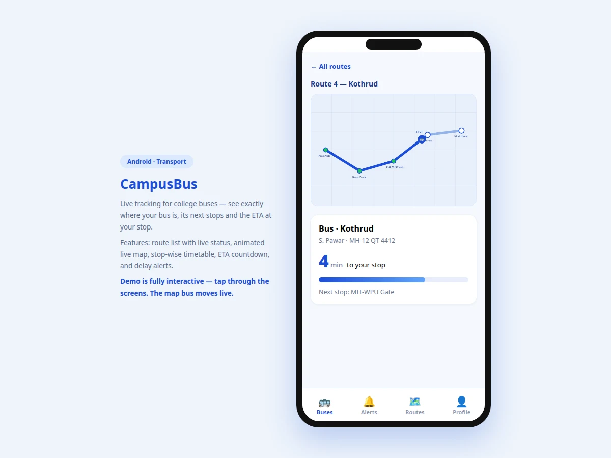
College bus commuters live with uncertainty: the bus is "usually" at the stop by 7:45, except when it isn't, and nobody knows whether it already left or is stuck in traffic. Students either wait 20 minutes in the sun or miss the bus entirely. Transport offices, meanwhile, field the same "where is bus 4?" calls every morning. This project builds the student-facing tracker as an Android app: a route list with live status badges and ETAs, a live map per route showing the polyline, color-coded stops and a moving bus marker, and a stop timetable distinguishing passed stops, the next stop and scheduled times. A progress bar and ETA countdown translate raw position into "6 minutes to your stop". The demo drives the map with a simulated position feed so every screen — including the moving bus — works without hardware; the architecture is designed around a real GPS feed from a tracker unit on each bus, polled over a simple REST endpoint.
Opens the app to find where their bus is.
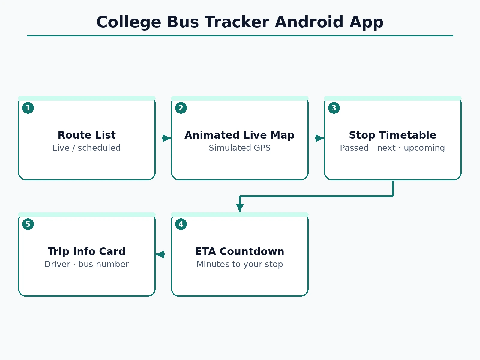
Follow the working sequence
How it works
- The app fetches the route list (routes, stops, schedules) and each bus's latest status from the tracker API (demo: local dataset).
- Route cards render with live/scheduled badges and ETAs computed from the bus's current segment.
- Opening a route draws the map: stop coordinates connected as a polyline, completed segments in the route color.
- The bus marker position interpolates along the polyline from the latest GPS fix; a timer advances the demo feed.
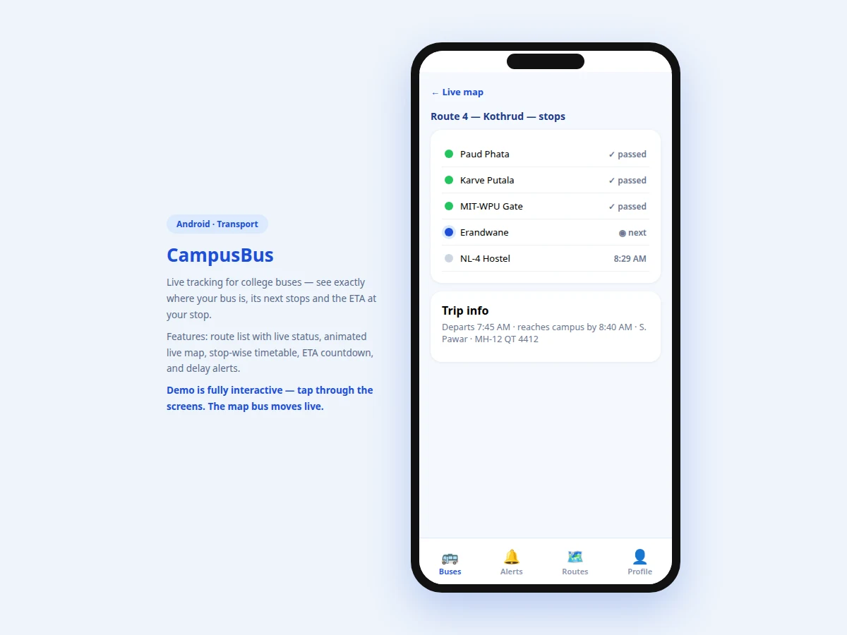
- Tapping the map opens the stop timetable: stops before the bus's position are marked passed, the nearest upcoming stop is "next".
- The ETA countdown derives from remaining segments and the bus's recent pace; the progress bar shows trip completion.
Tech stack:
- Android (Kotlin) — native app target
- Canvas / map rendering (route polyline, markers)
- REST API design (bus positions, routes, schedules)
- GPS tracker hardware interface (production feed)
- Push notifications (delay alerts, planned)
| Parameter | Value |
|---|---|
| Screens | 3 (routes, live map, stop timetable) |
| Demo routes | 4 routes, 5 stops each |
| Map | Route polyline + animated bus marker + stop states |
| ETA | Countdown in minutes + trip progress bar |
| Position feed | Simulated in demo; REST GPS API in production design |
| Target | Android 8.0 (API 26) and above (design target) |
Project features
- [Route list with live status] Each route card shows origin → campus, stop count, a LIVE or SCHEDULED badge, and the ETA or departure time.
- [Animated live map] The route polyline renders with stops; the bus marker moves along the route in real time, with completed segments highlighted.
- [Stop-wise timetable] Passed stops ticked green, the next stop highlighted, upcoming stops with scheduled times — the full trip at a glance.
- [ETA countdown] A big, glanceable "minutes to your stop" figure plus a progress bar, updated as the bus moves.
- [Trip info card] Departure and arrival times, driver name and bus registration number for each trip.
- [Delay awareness] When the bus is behind its scheduled pace, the ETA reflects it — no more "it should have been here" guessing.
- [Simulated GPS demo] The demo animates the bus along the route so the entire tracking UX is testable without tracker hardware.
What is included
- Complete Android app source code (Kotlin)
- Tracker REST API design (positions, routes, schedules)
- Map rendering module (polyline, markers, animation)
- Demo route dataset (4 routes, stops, schedules)
- Project report PDF (background, GPS tracking concepts, ETA math, methodology)
- PPT presentation for final review
- Viva Q&A preparation document (Android, location APIs, interpolation, REST polling)
Limitations & prerequisites
- The demo's moving bus is simulated — it does not track a real vehicle. Real tracking needs a GPS unit on each bus feeding the documented API.
- GPS accuracy in production depends on the tracker hardware and network; urban-canyon error of 10–30 m is normal and the report says so.
- The ETA model assumes roughly constant pace between stops; heavy traffic jams are reflected only when new positions arrive (polling interval, design target 15 s).
- Only the student tracker is built; the driver app and transport-office dashboard are documented as companion scope.
- Geofence-based "bus arriving" auto-alerts are designed but need the backend push setup to go live.
Frequently Asked Questions
Does the demo track a real bus?
No — the demo animates a simulated position feed so you can evaluate the whole UX without hardware. The production design consumes real GPS positions from a tracker unit on each bus via the documented REST API.
How is the ETA calculated?
From the bus's current segment and its recent pace across segments — remaining distance divided by observed speed, essentially. The demo shows the same math running on simulated positions.
What hardware does the real version need?
A GPS tracker unit per bus (GPS + cellular module) reporting position every ~15 seconds to the backend. The app itself needs no changes — it just reads the API.
What happens in a tunnel or no-network zone?
The app holds the last known position and marks the feed stale; the map shows "last updated" honestly rather than guessing.
Can parents track the bus too?
The same API can feed a parent view — the report lists a read-only parent mode as a natural extension with privacy controls.
Is this project suitable for a final-year project?
Yes — for Computer Science, IT and mobile-development programs. It demonstrates location concepts, real-time UI, API design and a problem every campus understands. Suitable for B.E./B.Tech final-year projects in Computer Science, Information Technology and Mobile Application Development.
Components & software requirements
- Android (Kotlin) — native app target
- Canvas / map rendering (route polyline, markers)
- REST API design (bus positions, routes, schedules)
- GPS tracker hardware interface (production feed)
- Push notifications (delay alerts, planned)
Delivery information
Built-to-order project. Delivery timeline is shared after order confirmation based on current queue.
Support terms
Complete documentation, setup guide, and viva preparation included. Support for setup and explanation provided.
Download free synopsis (PDF)
Enter your name and WhatsApp number — the synopsis PDF downloads immediately. We may send occasional project updates on WhatsApp; no spam.